


CartoDruid - GIS offline tool
Opis CartoDruid - GIS offline tool
CartoDruid to aplikacja GIS opracowana przez Instituto Tecnológico Agrario de Castilla y León (ITACyL), zaprojektowana jako narzędzie wspierające prace w terenie. Rozwiązuje problem edycji offline informacji georeferencyjnych.
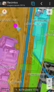
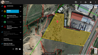
W wielu obszarach terenowych o niewystarczającym zasięgu mobilnym CartoDruid stanowi niezawodne rozwiązanie umożliwiając wizualizację warstw rastrowych i wektorowych przechowywanych na urządzeniu. Umożliwia tworzenie nowych geometrii (obiektów) poprzez rysowanie ich bezpośrednio na ekranie lub przy użyciu wbudowanego lub zewnętrznego GPS.
CartoDruid jest przyjazny dla użytkownika i nie wymaga wcześniejszej znajomości GIS, dzięki czemu jest łatwy w konfiguracji i obsłudze dla każdego, kto zarządza informacjami z prac terenowych. Wygenerowane dane można eksportować do wykorzystania w aplikacjach zewnętrznych.
Funkcje CartoDruid obejmują:
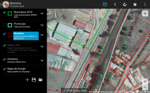
Wizualizacja internetowych Map Google.
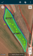
Wykorzystanie kartografii wektorowej w bazie danych SpatiaLite.
Obsługa obrazów rastrowych z bazy danych RasterLite.
Zużycie usług WMS online.
Tworzenie i konfiguracja nowych warstw na urządzeniu.
Filtrowanie, symbolika, etykietowanie, wyszukiwanie i identyfikacja formularzy na podstawie zapytań SQL.
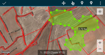
Edycja atrybutów i ręczne rysowanie geometrii.
Rysowanie i edycja geometrii w oparciu o GPS.
Zaawansowane narzędzia do edycji geometrii.
Funkcje oszczędzania danych, w tym dane georeferencyjne i kojarzenie zdjęć z obiektami.
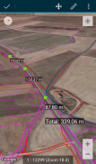
Dodatkowe narzędzia, takie jak wyszukiwarka SIGPAC, narzędzia pomiarowe, pomoce nawigacyjne, zarządzanie zakładkami.
Funkcje importu i eksportu w wielu formatach.
Zarządzanie spisem treści i obsługa plików SHP jako funkcja eksperymentalna.
Kontrole operacji na warstwach.
CartoDruid korzysta z usług lokalizacji w tle do tworzenia funkcji opartych na śledzeniu lokalizacji. Lokalizacja użytkownika służy wyłącznie do tworzenia wierzchołków geometrii lub pozycjonowania mapy, przy czym dane są przechowywane lokalnie i nie są wysyłane na zewnątrz urządzenia. Usunięcie folderu projektu pozwala na łatwe usunięcie danych.
Pełną listę funkcji, przykłady do pobrania i przewodniki początkowe można znaleźć na stronie www.cartodruid.es.
CartoDruid - GIS offline tool - Wersja 0.63.3
(12-06-2025)CartoDruid - GIS offline tool - Informacje APK
Wersja APK: 0.63.3Pakiet: es.jcyl.ita.crtdrdNajnowsza wersja CartoDruid - GIS offline tool
Inne wersje


Apki w tej samej kategorii


Mogą Cię się spodobać...


